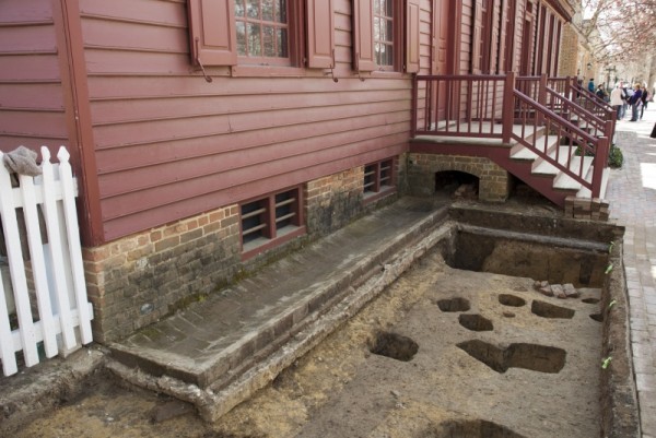
Among the signs of spring in the Historic Area is the return of archaeologists to the field. Beginning in March, visitors may have noticed a small excavation along Duke of Gloucester Street in front of Wetherburn’s Tavern. Want to know why archaeologists picked that spot, and what they found? Read on:
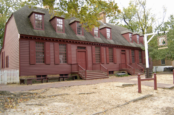
Wetherburn’s with its two reconstructed stoops.
Over the last couple of weeks, Colonial Williamsburg’s archaeologists have been busy examining the front of one of Duke of Gloucester street’s most iconic buildings – Wetherburn’s Tavern. Named for its mid-eighteenth-century proprietor Henry Wetherburn, the tavern is among Colonial Williamsburg’s 88 original structures. The oldest portion of the building—its east end- was built around 1740, and a decade later, the tavern was expanded with the addition of a large “Great Room” to the west. Evidence for two small stoops providing access to each of the tavern’s doors, was discovered during restoration of Wetherburn’s Tavern in 1965. It is these reconstructed porch features that bring visitors to the front doors today.
But the Frenchman’s Map of 1782 shows a different configuration. By the end of the American Revolution, these two porches gave way to a single long porch that spanned nearly the entire front of the tavern. The goal of the current archaeological project is to better understand how and when that change was made, with an eye toward possible reconstruction of the Revolutionary War era porch.
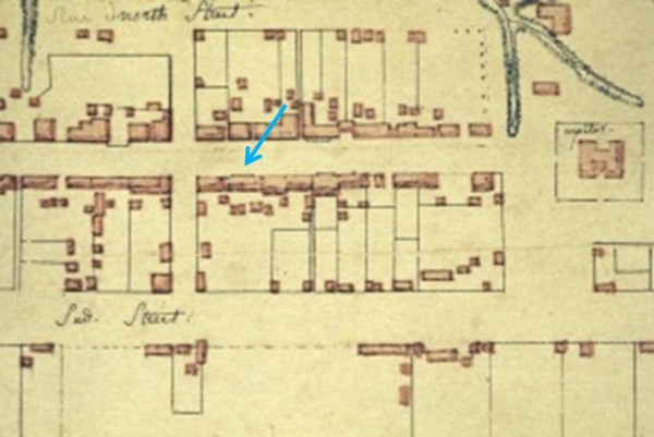
Frenchman’s Map showing a long porch on Wetherburn’s Tavern.
The Frenchman’s Map has long been an invaluable tool guiding Colonial Williamsburg’s archaeological efforts. Time and again this document has been a reliable indicator of building, fence, and even tree locations in 1782. But what the map doesn’t provide are the details: when were buildings or fences constructed, or trees plated? What materials were used in construction: brick, wood, or a combination of the two? Scale is another limitation. The map shows the relative size of buildings – small, medium or large, but doesn’t give precise dimensions. So while the Frenchman’s map provides a good start, archaeological excavation is needed to flesh out the details. In the case of the 1782 porch on Wetherburn’s Tavern, we have a number of questions including:
When was the long porch built? At what point were the two small stoops removed and replaced with the long porch?
How long did the long porch survive? Early 20th century photos of Wetherburn’s Tavern show a much smaller porch, indicating that the 1782 porch was replaced prior to when the first photos of the building were taken.
What materials were used? Did the porch sit on masonry piers, or was it held up on wooden post set into the ground?
How big was the porch? Excavations at two contemporary establishments — the Raleigh Tavern and Richard Charlton’s Coffeehouse — revealed 8-feet deep porches. These would have been spacious enough to allow patrons to eat and drink at tables and chairs. Did Wetherburn’s patrons enjoy the same amenities? As to the porch’s length, the Frenchman’s Map suggests it spanned the front of the tavern, but did not extend all the way to its corners. How far short did it stop?
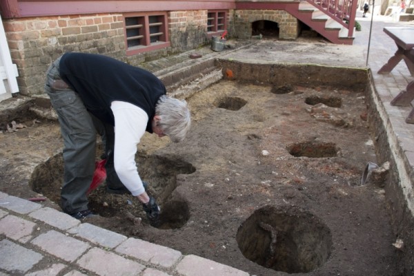
As with any investigation, our ability to address these research questions is constrained by survival of archaeological evidence. In front of Wetherburn’s Tavern, utility excavations, landscaping, and building modifications have all had impacts on the site’s eighteenth century archaeological resources. Further tempering our expectations was the fact that in 1965, archaeologist Ivor Noel Hume excavated a 4-foot wide trench across the front the tavern, but noted few preserved features. Undeterred, we hoped to improve our luck by extending our excavations further out from the building, electing to archaeologically excavate a 3 x 6-meter trench (roughly 10 x 20-feet) at the tavern’s northeast corner.
So what have we learned?
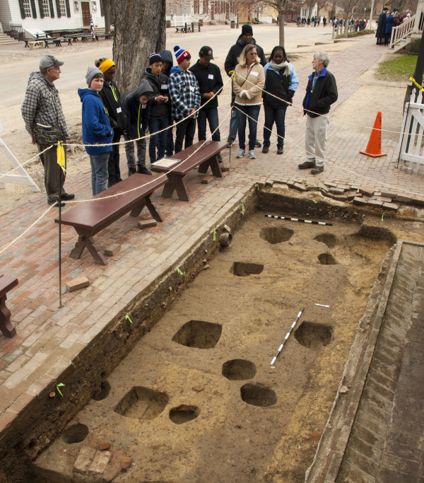
Archaeology always draws a crowd!
After excavating several 20th-century features including a bush planting holes, at least one early twentieth century fence line, and a deep trench for a 1920s-era cast-iron sewer line, we were pleasantly surprised at the extent of the porch-related archaeological evidence. In particular, we uncovered the rubble remains of two brick piers exactly 8-feet north of the tavern. The archaeological evidence was clear that the porch rested on brick rather than wood supports. Moreover, the piers’ distance from the building indicated a porch depth equal to those previously found at the Raleigh and Coffeehouse. Finally, the eastern-most pier – likely the porch’s corner – was located roughly 2-feet in from the tavern’s northeast corner. Just as the Frenchman’s Map showed, the archaeological evidence confirmed that the 1782-porch did not extend all the way across the front of the building.
In addition to the porch’s preserved physical remains, we also determined useful chronological evidence. Both pier remnants were covered by a distinctive layer of brick and mortar rubble that accumulated as a result of the porch’s demolition. From that demolition layer we retrieved several mocha-decorated refined earthenware ceramic fragments – a ceramic type not manufactured until the 1790s. The fact that the mocha-decorated pottery was embedded in the demolition layer thus dates its likely accumulation to the early nineteenth century. As for a construction date for the porch, we were unable to further refine the date other than to say the change from two to one porches occurred sometime before 1782.
We did, however, make one additional very significant discovery that pre-dated the 1782 porch. We’re still sorting out that evidence, but check back soon for a full report…….!
Contributed by Mark Kostro, Staff Archaeologist

Katy Wright says
Thank you so much for sharing! I will be staying tuned to hear the rest of the exciting discovery!! It is truly amazing what the archeaologists can learn about the history of this amazing town!
Can’t wait to hear what else you found!